


2022-01-16 Tour des plaines du Teich

eric.mignot
User
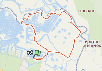

Length
5.5 km

Max alt
5 m

Uphill gradient
21 m
Km-Effort
5.8 km

Min alt
-2 m

Downhill gradient
21 m
Boucle
Yes
Creation date :
2022-01-16 14:28:49.886
Updated on :
2022-01-16 17:29:56.51
1h31
Difficulty : Easy

FREE GPS app for hiking
 SityTrail
IGN / Geographical institutes
SityTrail Plus
The world is yours!
About
Trail Walking of 5.5 km to be discovered at New Aquitaine, Gironde, Le Teich. This trail is proposed by eric.mignot.
Description
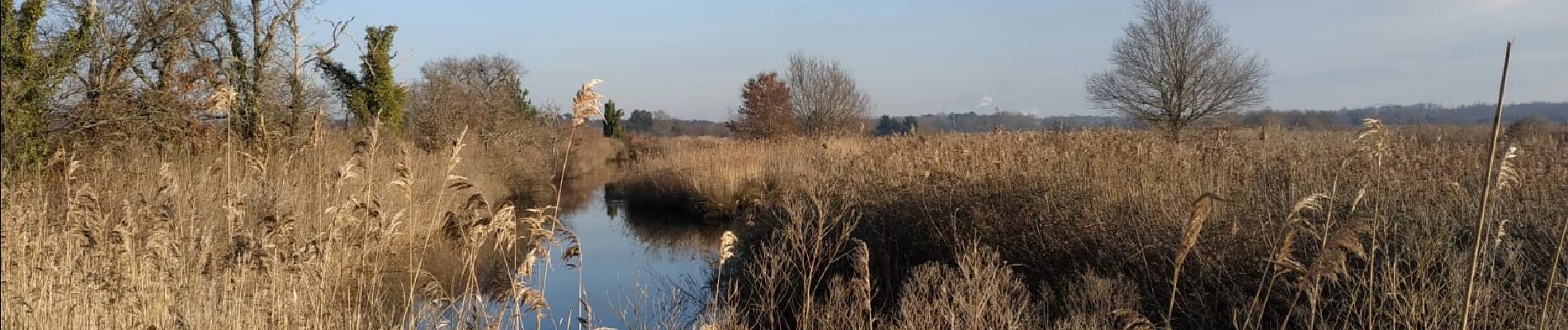
Depuis le port du Teich, d'un bras à l'autre de la Leyre.
Sentier pouvant être très boueux et glissant ! à éviter si alternance de gel et dégel.
Photos

Positioning
Country:
France
Region :
New Aquitaine
Department/Province :
Gironde
Municipality :
Le Teich
Location:
Unknown
Start:(Dec)
Start:(UTM)
657286 ; 4944860 (30T) N.
Comments